
Winnebago ZIP Directory Coverage
The official WinGIS Zip Codes layer returns 32 postal records across its regional mapping extent. It supplies PostCode and PostalCity fields, making it a strong local geography source. It is not a USPS ruling that each polygon falls wholly inside Winnebago County. The table groups the captured labels so users can see the county core, PO-box entries, and edge labels without inventing post-office station names that the research did not establish.
| ZIP | Areas or postal label | Post office | Research note |
|---|---|---|---|
| 61016, 61063, 61088 | Cherry Valley, Pecatonica, Winnebago | Verify with USPS | County-area postal cities |
| 61072, 61073, 61080 | Rockton, Roscoe, South Beloit | Verify with USPS | Northern county area |
| 61024, 61019, 61079 | Durand, Davis, Shirland | Verify with USPS | Village and rural labels |
| 61101-61104, 61107-61109, 61111-61112, 61114-61115 | Rockford and Loves Park delivery areas | Verify each address | Municipal lines do not equal ZIP lines |
| 61105, 61106, 61110, 61125-61126 | Rockford or Loves Park PO-box records | PO-box service | Not a normal street-delivery polygon |
| 61008, 61010, 61047, 61054, 61065, 61084, 61049 | Belvidere, Byron, Leaf River, Monroe Center, Poplar Grove, Stillman Valley, Lindenwood | Verify with USPS | Regional edge labels; county membership varies |
Use the ZIP code directory as an index to delivery geography. The exact street address remains the unit that USPS can verify, while the parcel PIN identifies land in county systems.
Mapping Winnebago ZIP Codes
The official Rockford GIS Zip Codes service exposes each polygon with its postal code and postal-city label. It is useful for seeing where a delivery area sits in relation to streets. The address-point layer also has a ZIP field, and some parcel maps began displaying ZIP information after the 2026 WinGIS releases.
Review the official GIS service before reading the captured layer.
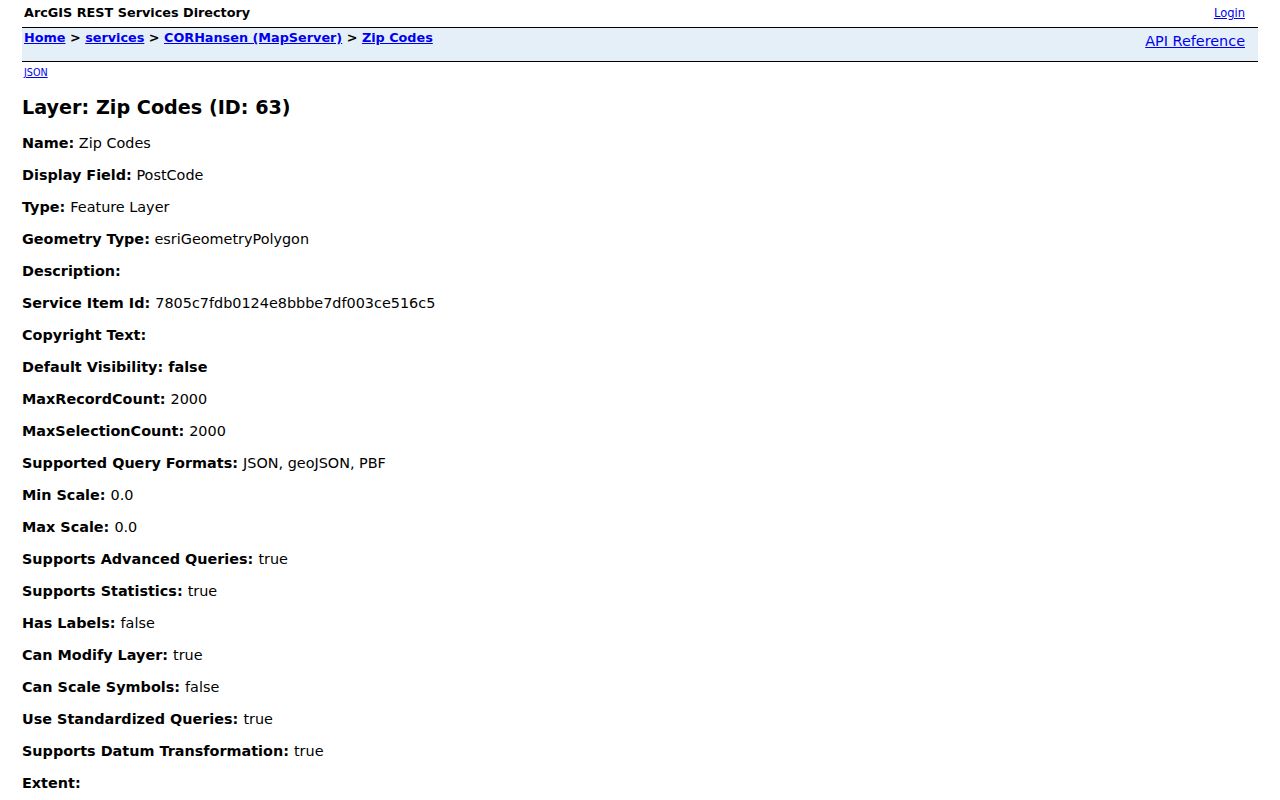
The image shows the official map-service source, but an address-level USPS check remains necessary when a polygon touches a city or county edge.
A map layer is not an owner roll. Pair the polygon with an address point or parcel. Save the field name, layer date, and portal release because geographic data and interfaces change.
Winnebago Postal-City Quirks
A postal city is the place name USPS associates with delivery, not a legal statement about municipal government. The regional WinGIS layer contains Rockford, Loves Park, Cherry Valley, Winnebago, Rockton, Roscoe, South Beloit, Durand, Pecatonica, and other labels. It also contains edge names such as Belvidere, Davis, Leaf River, and Stillman Valley. Their appearance proves that the service maps a regional postal footprint, not that all land under each name is in Winnebago County.
This distinction matters when a name search returns an address. Compare four separate labels: postal city, county, municipality or city-limit status, and parcel jurisdiction. An unincorporated pocket may use a familiar city name for mail while remaining outside that city. Never turn the ZIP into a neighborhood name.
Boundary check. Treat the postal label as delivery data, then verify county and municipality with official parcel and city-limit layers.
Finding Winnebago Residents by ZIP
Only claim ZIP filtering when the official form shows it. The assessor and Treasurer forms inspected for Winnebago County did not display a ZIP search field. The dynamic voter lookup did not yield a stable ZIP control during research. I-CASH does accept ZIP, and WinGIS provides geographic ZIP fields rather than a ZIP-only owner list.
- Verify the complete delivery address with the USPS ZIP Code Lookup.
- Open WinGIS and compare the ZIP polygon with the address point, parcel, and municipal boundary.
- Use the parcel PIN to move into assessor, Treasurer, or deed records. Read owner and taxpayer mailing addresses as distinct from occupancy.
- For a name-based state search, use a portal only if ZIP appears as a documented field. Confirm any match with another official record.
Once the search narrows to a named road, the Winnebago County street directory explains the address and parcel chain in full.
Winnebago ZIP-Keyed State Search
The Illinois Treasurer's I-CASH claim search is the clearest official example of ZIP narrowing. Last or business name is required. First name, city, ZIP Code, and Property ID are optional fields. A search can begin a claim, and the Treasurer may ask for documents proving identity or relationship. Property is returned at no cost through the state when the claim is valid.
| Field | Use | Required |
|---|---|---|
| Last or Business Name | Primary claimant-name search | Yes |
| First Name | Narrows an individual match | No |
| City | Narrows by listed locality | No |
| ZIP Code | Narrows by listed postal code | No |
| Property ID | Targets a known claim record | No |
An I-CASH hit does not prove current residence. It shows that Illinois holds property associated with the submitted search terms and that a formal claim process exists.
WinGIS ZIP Fields Changed
The WinGIS release record is important because the search surface changed through 2026. May updates improved combined PIN, address, and owner filters, pagination, sorting, table view, and CSV functions for permitted users. June added ZIP codes to parcels on some maps. Later releases refined Parcel Summary, and August added mass parcel highlighting with address and parcel-number labels plus a two-list comparison option.
Read the official release page before reviewing the captured update history.
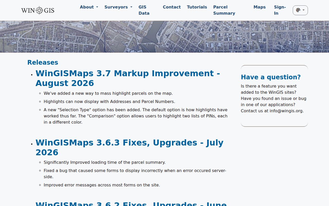
The release history explains why an older screenshot or set of steps may not match the current portal. It does not turn a parcel map into a list of occupants.
For repeatable work, record the date, map name, parcel PIN, and fields used. A PIN is more stable than a ZIP when the goal is to follow the same parcel across tax, deed, and map systems.
PO-Box ZIPs in Winnebago
The GIS capture includes Rockford PO-box records and Loves Park PO-box records. A PO-box ZIP groups mail received at boxes rather than outlining ordinary home-delivery streets. It should not be mapped as if it described a residential neighborhood. Research did not locate authoritative station names for every entry, so the table correctly sends exact assignments back to USPS.
Can a PO-box ZIP identify where someone lives? No. It can identify a mailing channel associated with a record. The physical address, county parcel, and municipal jurisdiction still require separate proof.
That rule also applies to an owner or taxpayer mailing address. A trust, business, bank, or person living elsewhere may receive the mail while the parcel sits in Winnebago County.
Winnebago ZIPs Versus Boundaries
A ZIP is not a census tract, voting precinct, school district, ward, flood zone, legal parcel, or city limit. Each serves a different job and can draw a different line. Rockford GIS offers city limits, addresses, parcel PINs, ZIP Codes, wards, flood and zoning areas, districts, aerials, and neighborhood associations. Overlaying them provides context, but the responsible office determines the legal boundary.
- ZIP and ZIP+4
- A five-digit delivery area and its more precise four-digit delivery segment.
- PO-box ZIP
- A postal code used mainly or solely for post-office boxes rather than street delivery.
- Unique ZIP
- A code assigned to one high-volume organization; no verified local example was established in the research.
- Carrier route
- A postal delivery path within a ZIP, not a parcel or municipal boundary.
Exact station assignments, local ZIP populations, split dates, and a county-adjudicated ZIP list were not found in the official sources inspected. Omitting those claims is more accurate than filling the gaps from a commercial map.
Historic Winnebago Addresses Predate ZIPs
Old Rockford sources should not be searched by modern ZIP alone. The 1857 city register describes streets by endpoints, and Rockford street numbers changed in 1893. Historic directories, Sanborn maps, and old newspaper notices may carry an earlier number or no postal code at all. Start with the street name, cross street, family name, or building, then bridge to a modern parcel through the legal description and current map.
This is a useful comparison: ZIP geography is designed for mail, while a parcel PIN is designed to track land. A historical address can change its number, postal label, or ZIP while the deed chain preserves the parcel identity. Use the city directory collections for names and old addresses, then WinGIS and recorder records for the modern match.